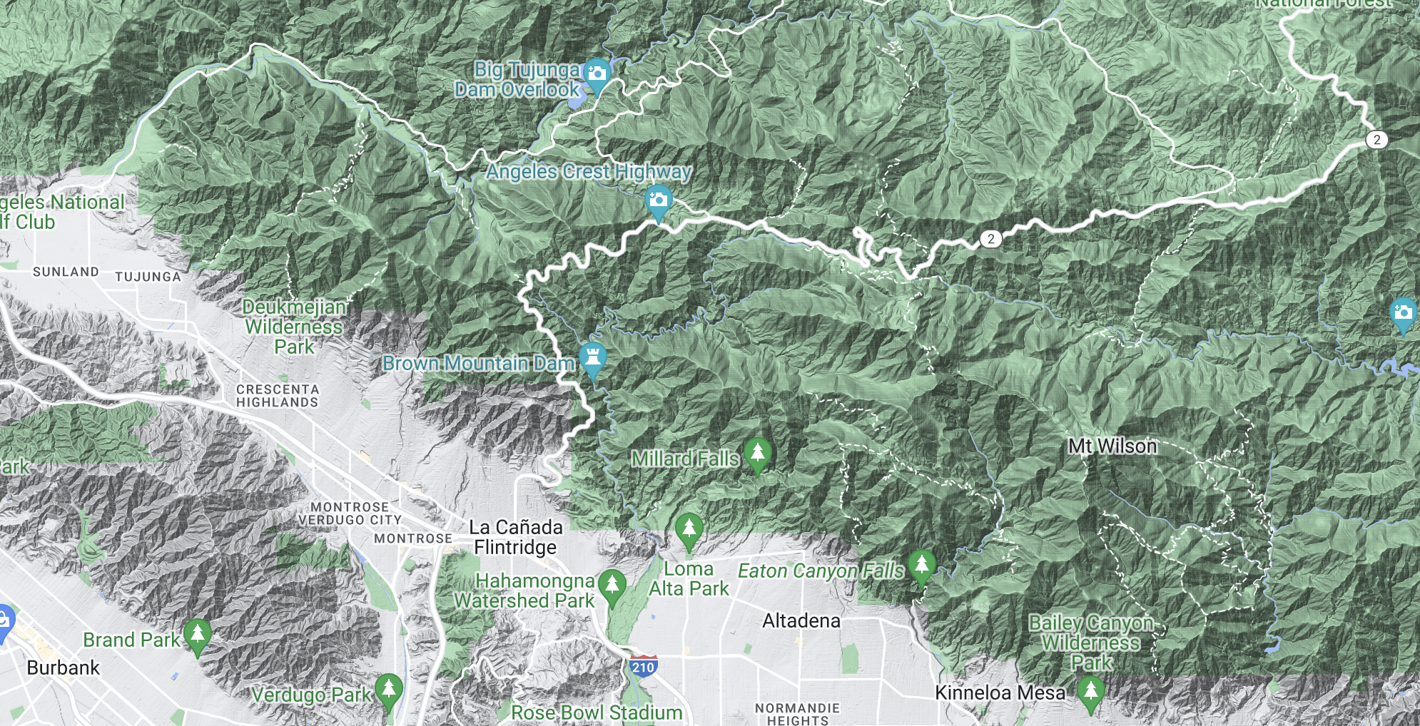
House Mountain Model
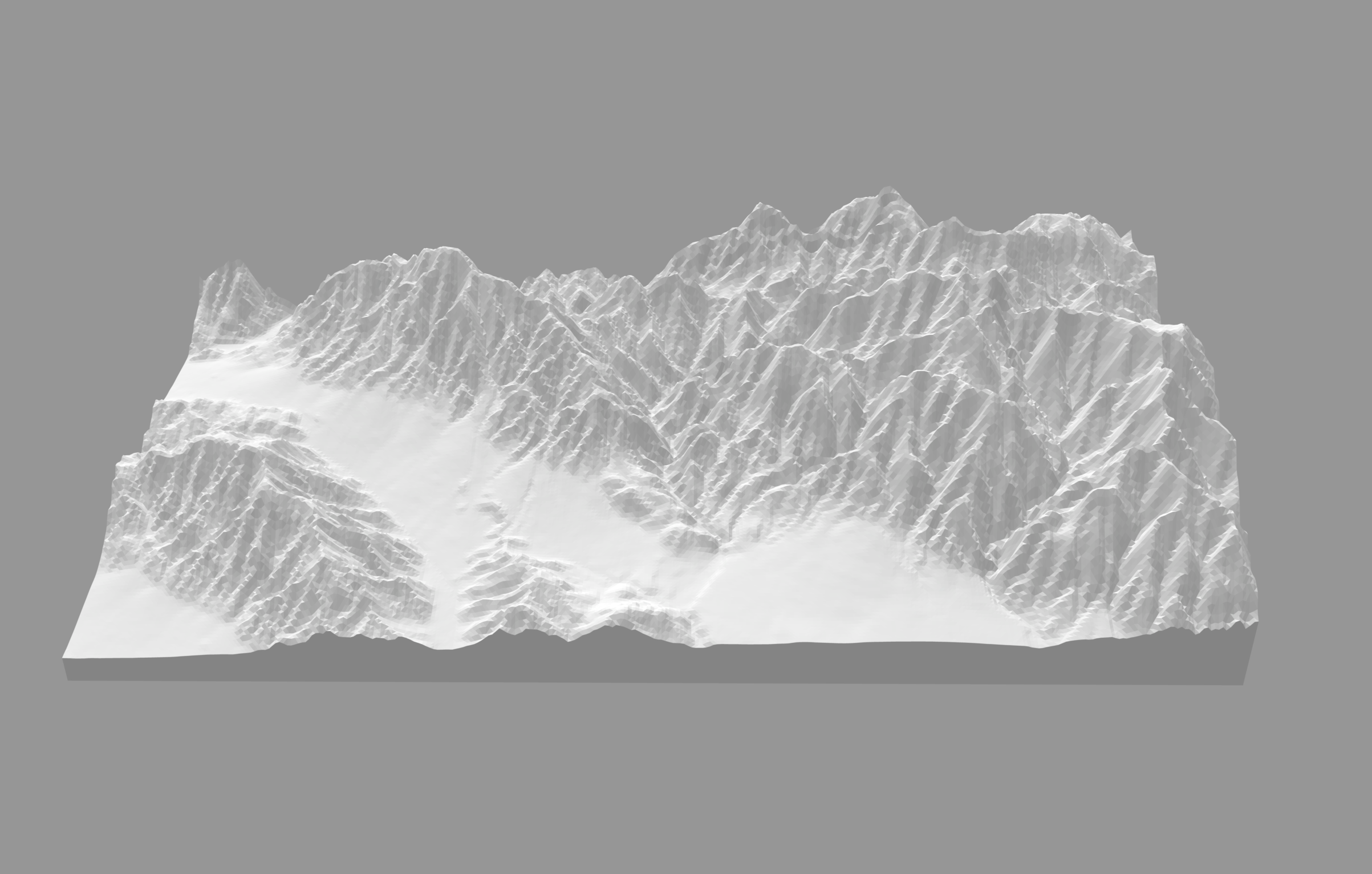
I’m not sure how, but at some point I came across this Instructables article on building models from maps. The article shows you how to use Terrain2STL and Kiri:Moto to get a portion of a map, generate a elevations file in STL format (originally designed for stereolithography, it’s a format supported by lots of 3D programs and tools), and convert that file into topographical slices.
So I revisited the House Mountain area, and went through the process. I chose to exaggerate the vertical considerably to make it more identifiable. The tools yielded me an SVG graphic of all the layers. I did further conversion, and cut the scene out of chipboard using CrashSpace’s Epilog laser.
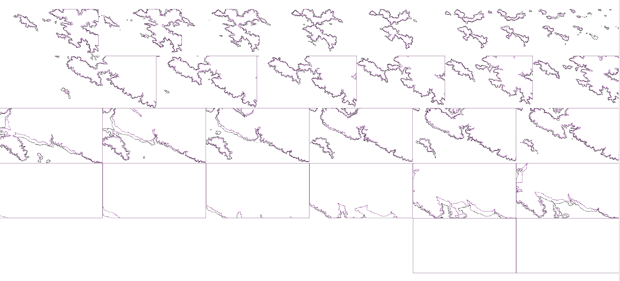
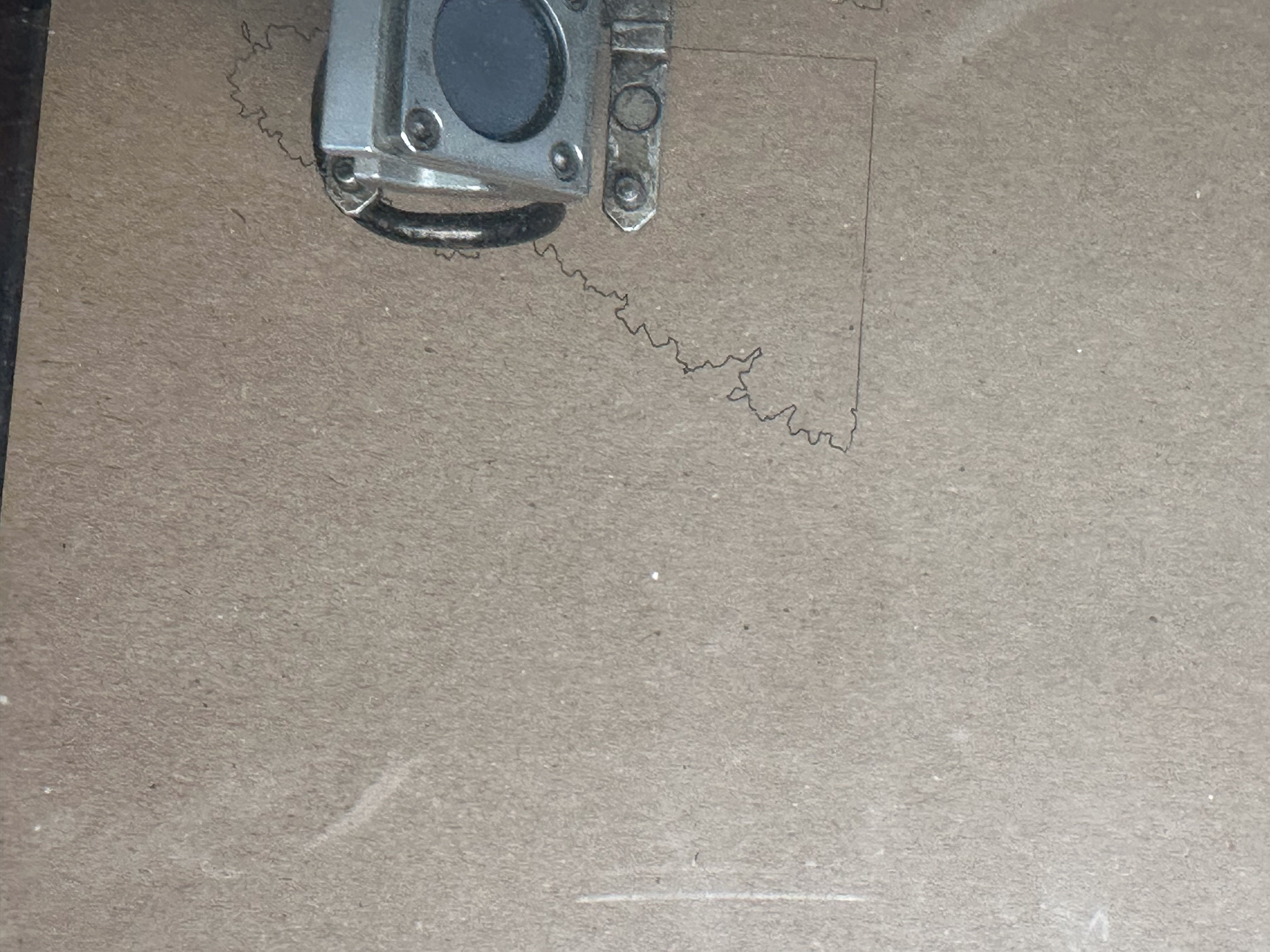
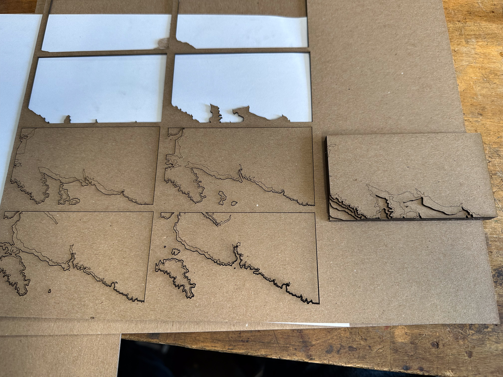
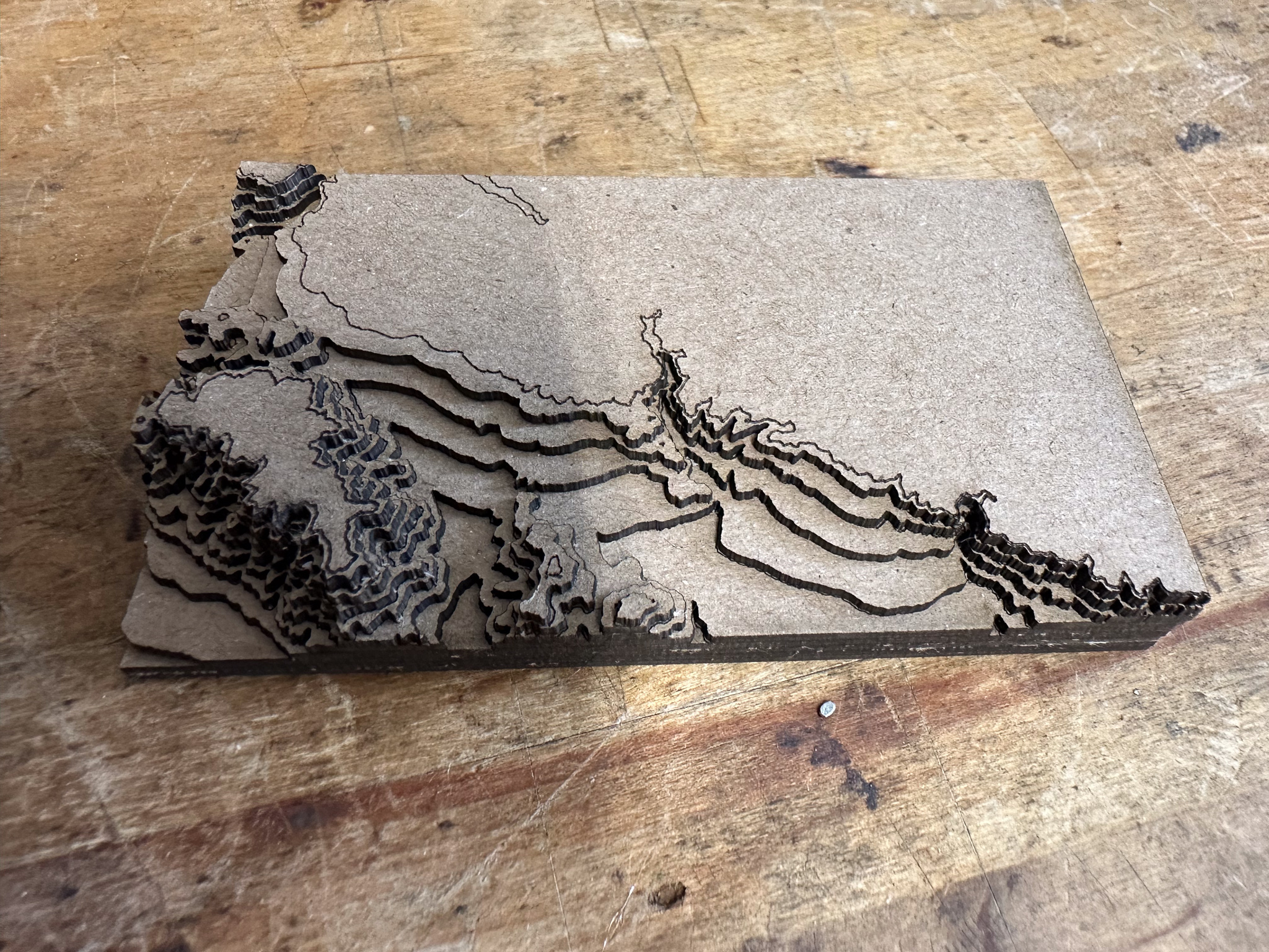
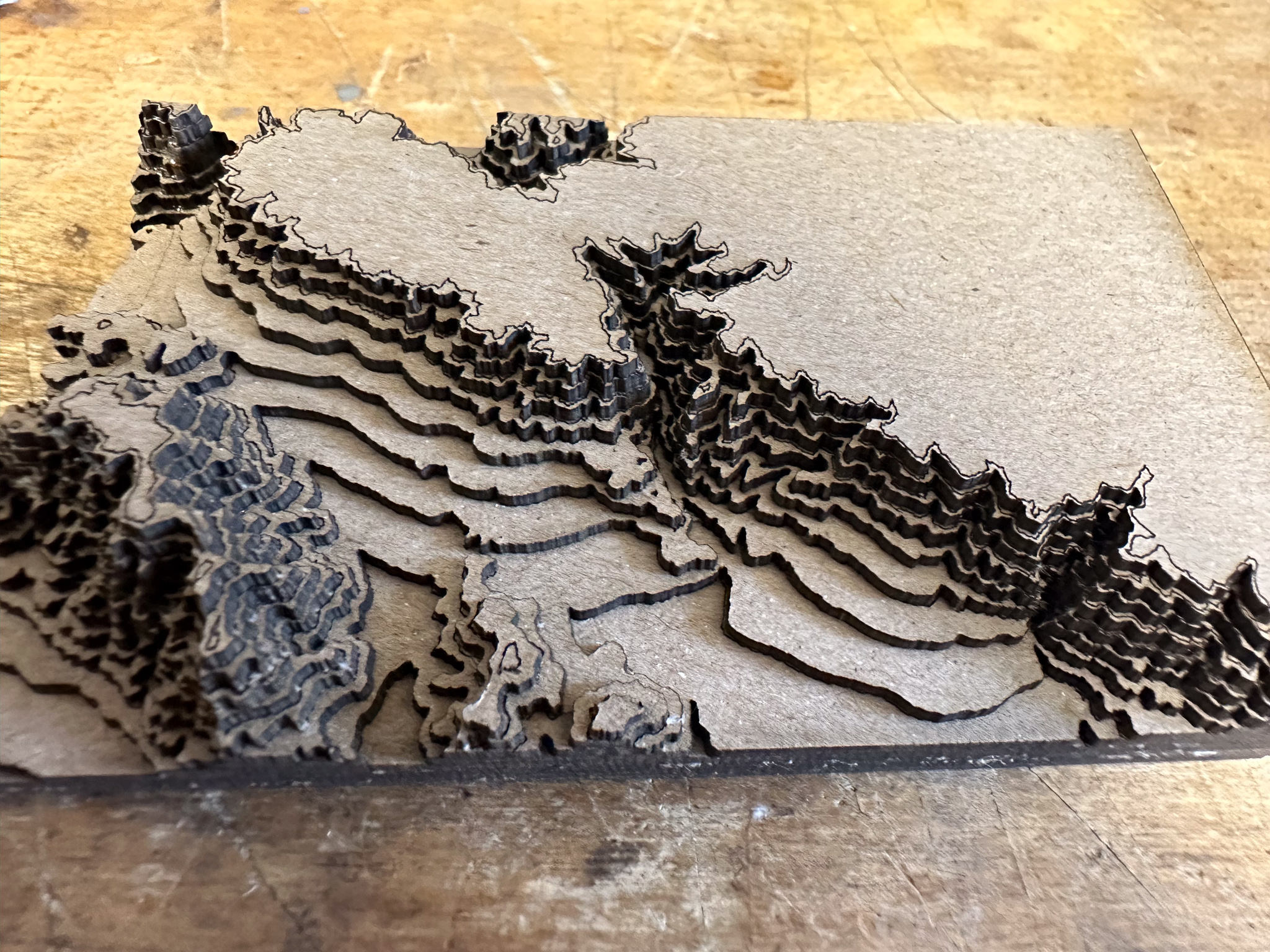
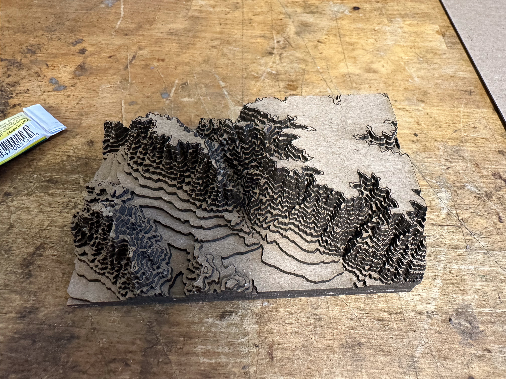
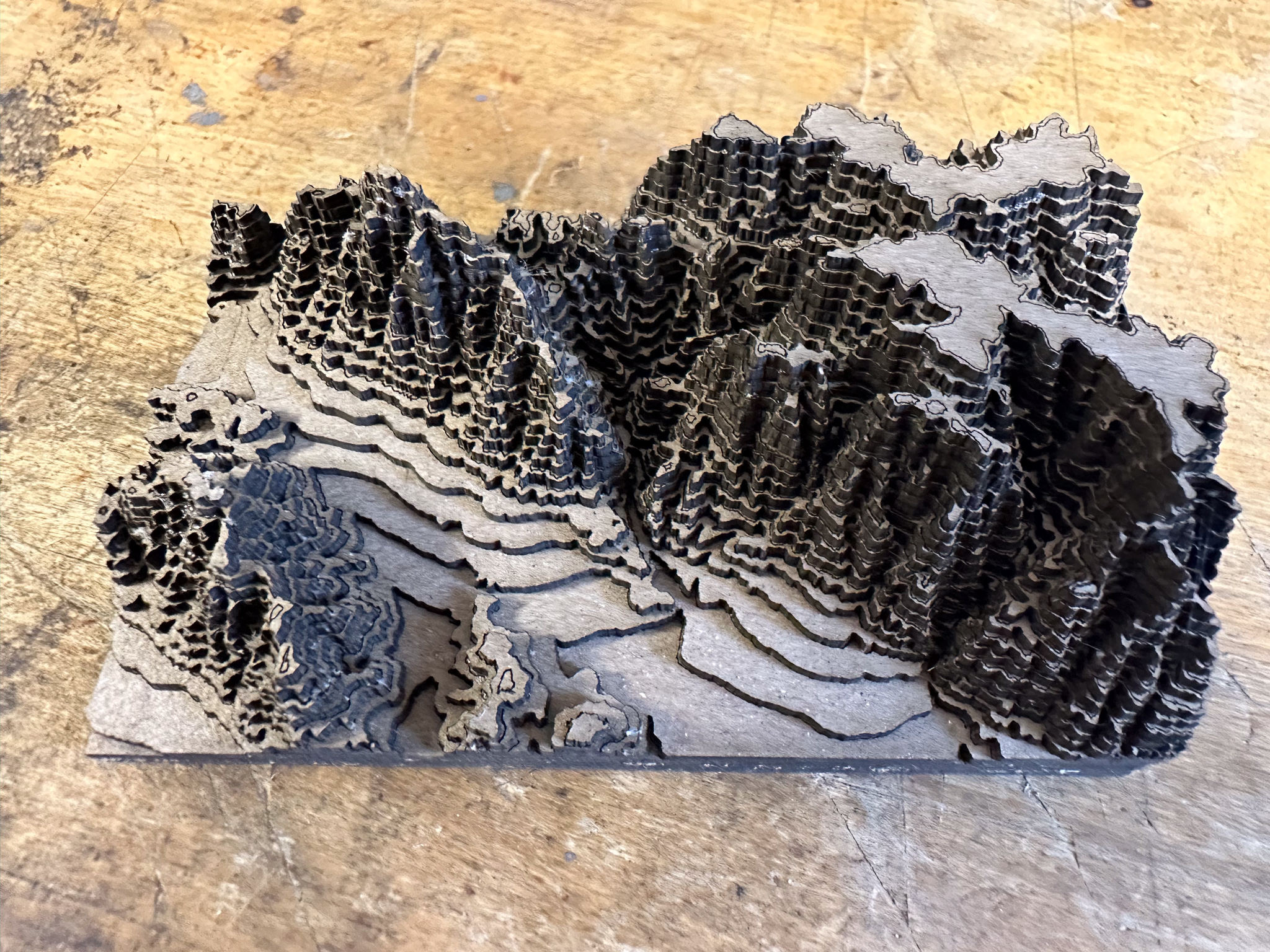
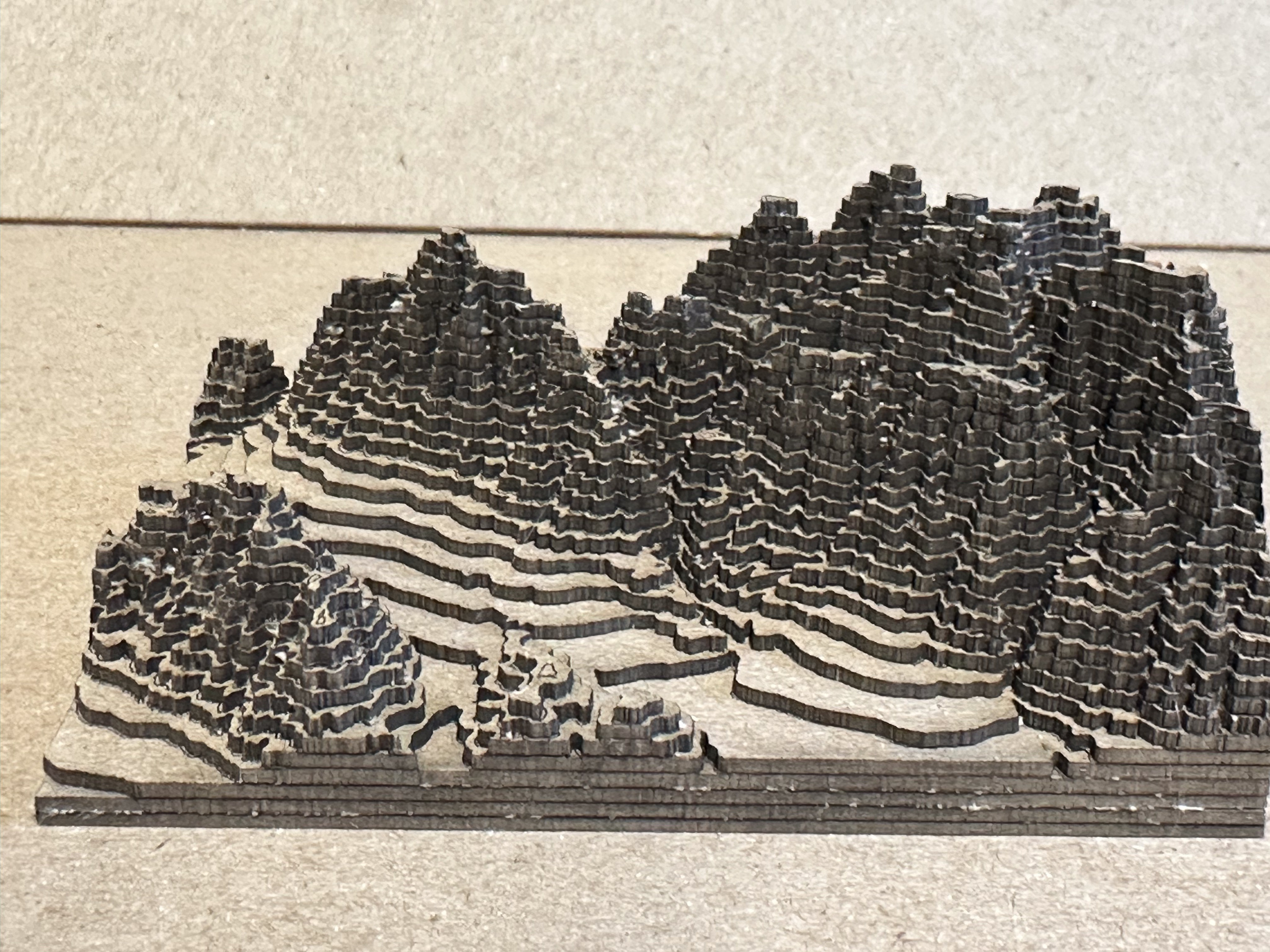
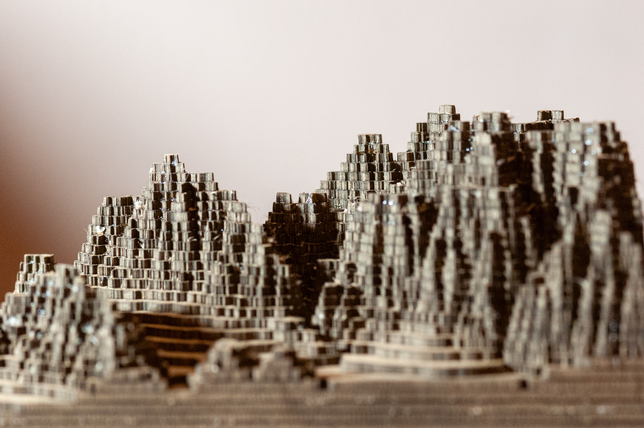
I lost many of the finer peak tops into the interstices of the laser cutter. Even the ones I did manage to keep were difficult to glue. I’d use a magnifier and tweezers if I were to do it again.
I’m tempted to 3D print the STL file on a filament printer. The output would certainly be smoother and more detailed.
Leave a Reply